Panurbana 183 het Buiten IJ
If magnifying glass does not appear, reload the page.
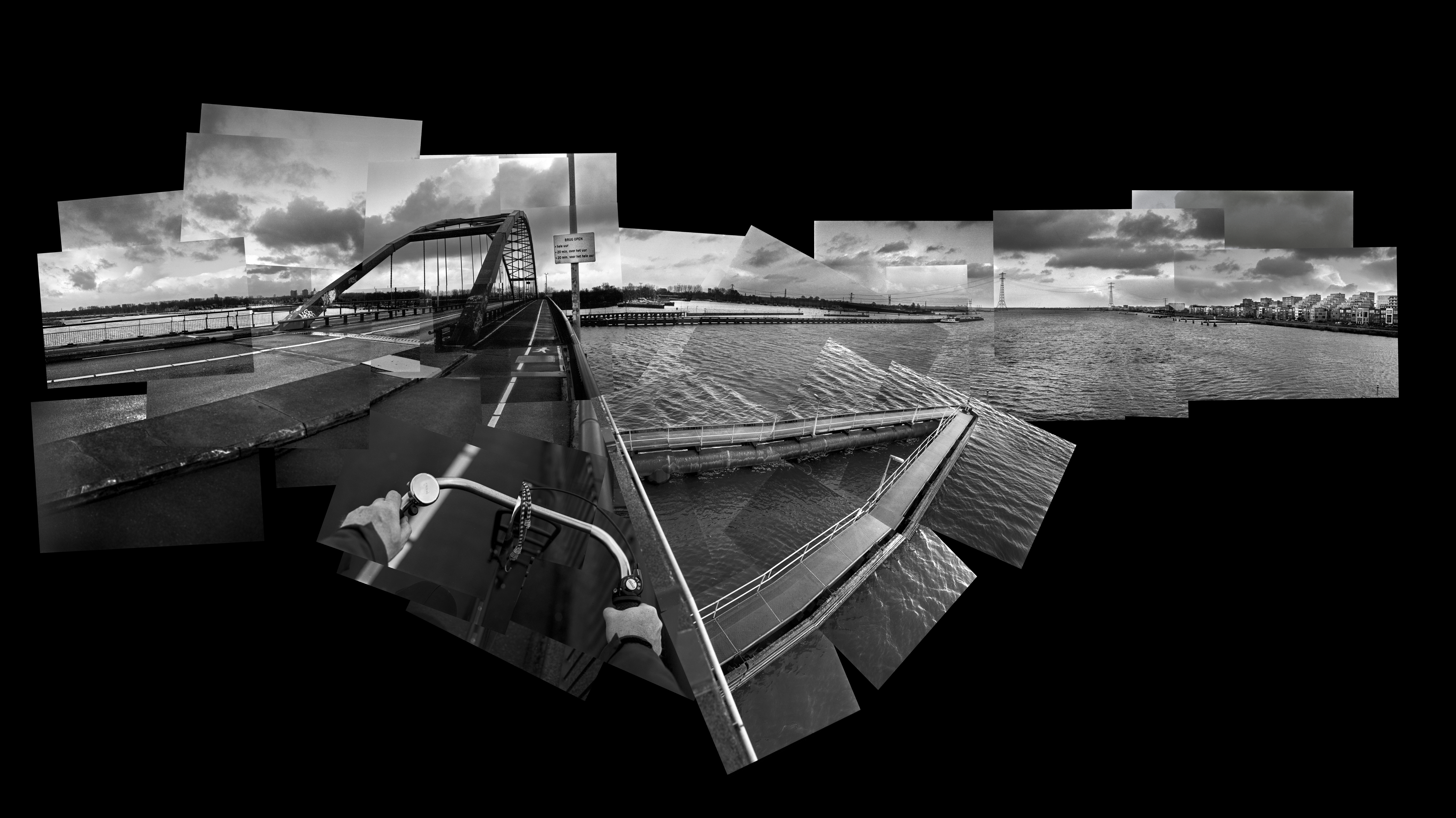
Panurbana 184
het Buiten IJ
Amsterdam Atlas
collage: 37 photos
format: 95 x 135 cm
Amsterdam 2023
The Buiten IJ is the water east of the city, between
the Oranjeslokken, the IJmeer and Markermeer.
The Binnen IJ is the closed water on the city side that extends
to the North Sea Canal, constructed in 1876.
The Oranje locks (1872) separate the Buiten IJ from the closed Binnen IJ
and regulate the water level of the North Sea Canal.
The Schellingwouder Bridge over the Buiten IJ (see also Panurbana 102) connects Amsterdam North
with Zeeburgereiland, on which approximately 8,000 homes will be built in the coming years.
Under the water of the Buiten IJ, the Zeeburgertunnel (1990), as part of the
ring road, connects Zeeburgereiland and Amsterdam North.
The Zeeburger Tunnel has a total length of 946 meters (of which 336 meters is underwater)
and is not accessible to pedestrians and cyclists. Bordering the Buiten IJ is the IJmeer and the IJburg district,
which also includes the islands of Steigereiland, Rieteilanden, Centrumeiland and Buiteneiland.